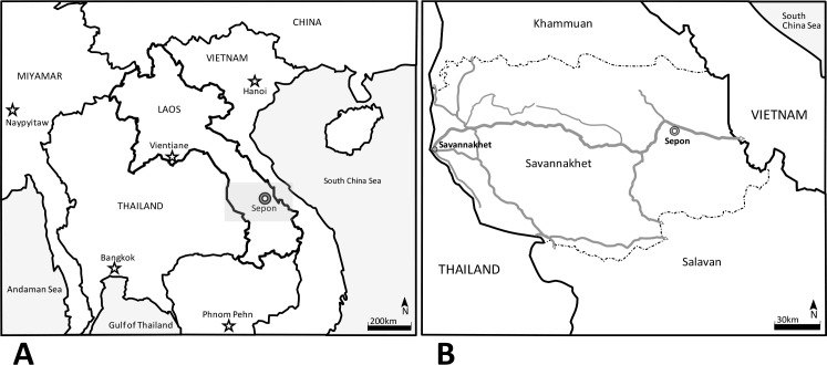
Fig 1.
Map showing Laos localization and its neighboring countries in “A” a detailed map of Savannakhet province in “B” (gray square in “A”). Stars represents the localization of the capital cities of the countries in the map on the left (A). Double circle marks signalizes the localization of Sepon, the study area in A and B and shows the proximity of the city with Vietnam. In B, continuous gray lines represent the main roads of Savannakhet Province, dash-dot lines are the borders of the provinces of Khammuan (north) and Salavan (south) and, continuous black lines are the Laos-Thailand and Laos-Vietnam borders in west and east respectively.

