
Figure 1.
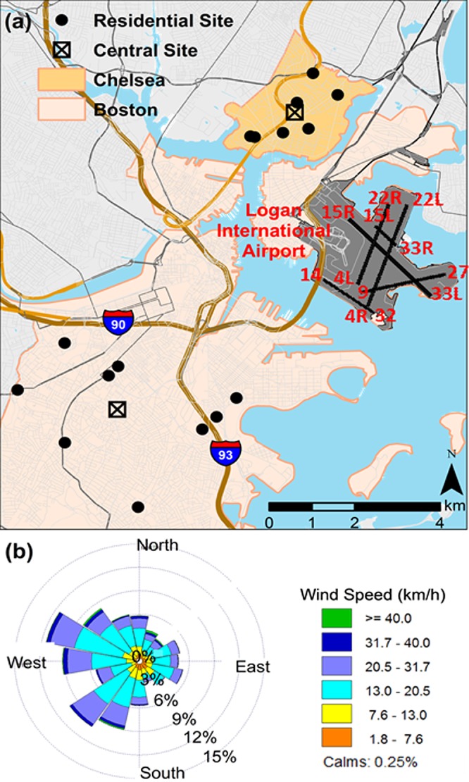
(a) Map of the runways at Logan International Airport and the locations of the central and residential monitoring sites in Chelsea and Boston. Base layers were obtained from mass.gov. (b) Windrose is based on 1 min data for 2014 reported by National Weather Service Automated Surface Station located at the airport.