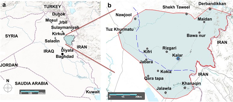
Fig 1. Geographical map of the study area around the Garmian region.
The map was created by Landsatlook viewer (USGS Products, Data available from the U.S. Geological Survey). The interrupted blue line indicates the borderline between the north and center of Iraq by previous Iraqi governments before 2003.

