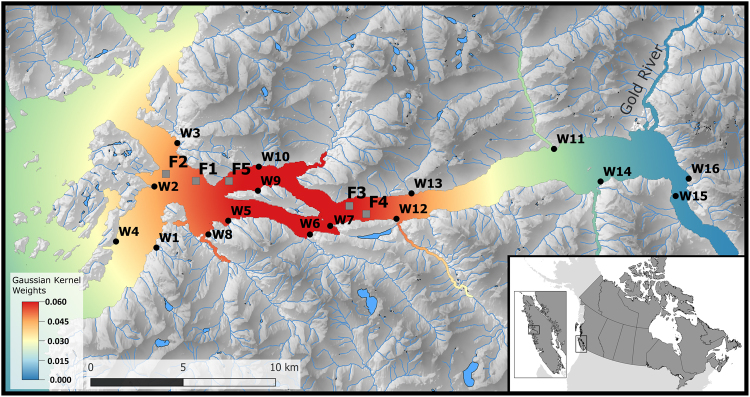
Figure 1.
Locations of the study farms (grey squares; F1–F5) and the sampling sites for wild out-migrating salmon (black circles; W1–W16) within the Muchalat Inlet, BC, Canada, between 2007 and 2016. The west of the inlet opens to the Pacific Ocean. The water surface map is a visual representation of the Gaussian kernel weights, as determined from the five farm locations. The kernel densities were calculated by simulating a point process to represent a kernel density with a 30 km bandwidth. The points were simulated with ‘splancs’ package, and the kernel density surface with ‘spatstat’ package in R version 3.3.2 (http://www.R-project.org), and the maps were generated with QGIS version 2.18.13 (http://www.qgis.org).

