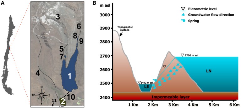
Figure 1.
(A) Map location of the lake system with geographical characteristics of the area. Significant details shown: (1) Laguna Negra; (2) Lo Encañado; (3) Echaurren glacier; (4) Meltwater flow feeding Lo Encañado; (5) and (6) Meltwater flows feeding Laguna Negra; (7), (8), and (9) Sediment retaining ponds; (10) Former land connection between both lakes (11) Direction of the water flux and location of the Manzanito and Maipo rivers. (B) Cross section showing topography and piezometric levels of both lakes.

