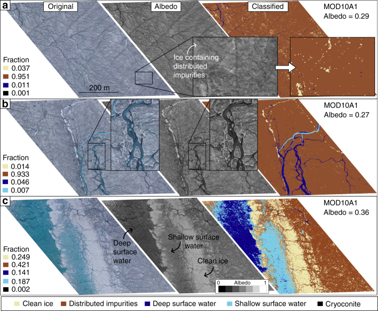
Fig. 5.
RGB digital image, albedo map and classification of surface types in three MOD10A1 pixels. The albedo maps were derived from the digital images (Methods). The locations of the segments along the UAV transect are shown in Fig. 1. a Segment characterized by mostly ice containing uniformly distributed impurities. b Segment characterized by similar ice surface to a but with a larger fraction of channelized surface melt-water. c Segment dominated by a supraglacial lake with a previous shore consisting of clean ice

