
Fig. 6.
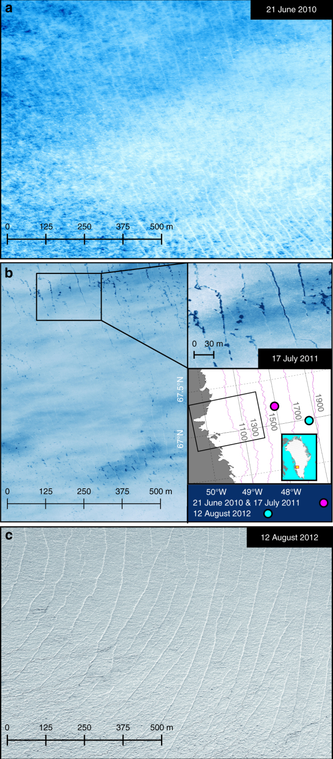
High-elevation crevasses on the Greenland Ice Sheet. a Worldview image acquired on 21 June 2010 showing snow-filled crevasses at 1540 m elevation, 95 km inland from the ice sheet margin (48.05°W, 67.20°N) during a cascading lake drainage event (see Fig. 1b–d for contemporaneous model outputs). b Worldview image showing water-filled crevasses in the same area on 17 June 2011. Inset shows approximate location of imagery (coloured dots) and domain of numerical model (black box). c Worldview image from 12 August 2012 showing high-altitude crevasses at the S10 site (47.165W, 66.985N) at 1800 m elevation, 135 km inland from the margin, which is where Doyle et al.16 observed year-on-year increases in ice flow consistent with forcing by supraglacial lakes (Imagery © 2018 DigitalGlobe, Inc.)