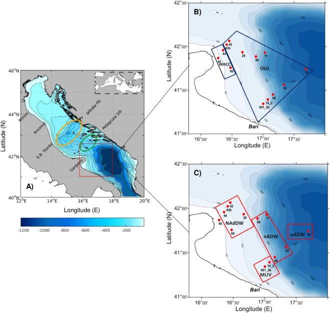
Figure 1.
Map of the investigated area (red frame) in the southern Adriatic Sea (A). Maps showing the localization of the sampling stations at surface (B) and deep (C) water layers. The yellow and green circles in map A depict the areas occupied by the Jabuka Pit and the Pelagruza Sill, respectively. Water masses’ acronyms: Shelf (Shelf Water), WACC (Western Adriatic Coastal Current), OUL (Offshore Upper Layer), MLIW (Modified Levantine Intermediate Water), NAdDW (Northern Adriatic Dense Water), nADW (new Adriatic Deep Water) and oADW (old Adriatic Deep Water). For water masses definition see the text. Six additional samples collected at the subsurface Deep Chlorophyll Maximum at stations 42 and 43b (Shelf), 44 (WACC), and 91, 93 and 94 (OUL) are not showed in the maps. Maps generated by using MATLAB 8.5 http://uk.mathworks.com/products/matlab (map A) and ODV 4.7.10 (Schlitzer, R., Ocean Data View, http://odv.awi.de, 2017, maps B and C).

