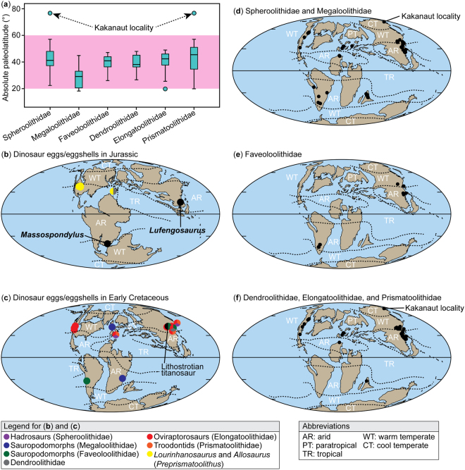
Figure 4.
Paleogeographic distribution of major dinosaur oofamilies. (a) Comparison of paleolatitude of dinosaur egg/eggshell localities, showing that most localities range within 20° and 60° (highlighted in pink) whereas spheroolithid and prismatoolithid eggshells are also known from higher latitudes (Kakanaut locality at 76.7°N). (b) Paleogeographic distribution of dinosaur egg/eggshell localities of Jurassic age. (c) Paleogeographic distribution of dinosaur egg/eggshell localities of Early Cretaceous. (d) Paleogeographic distribution of Spheroolithidae and Megaloolithidae in the Late Cretaceous (dots). (e) Paleogeographic distribution of Faveoloolithidae during the Late Cretaceous (dots). (f) Paleogeographic distribution of Dendroolithidae, Elongatoolithidae, and Prismatoolithidae during the Late Cretaceous (dots). The maps were created with Adobe Illustrator CS5 based on the original maps provided by Global Paleogeography and Tectonics in Deep Time ©2016 Colorado Plateau Geosystems Inc.

