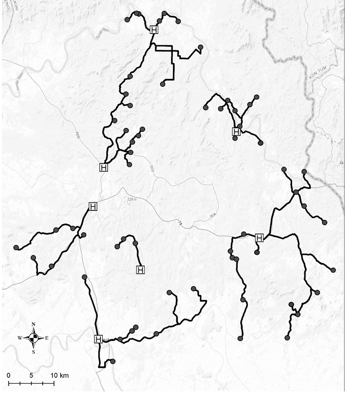
Fig 2. Map of study site in Ratanakiri province with actual travel route from 62 villages to their nearest health centers.
Black circle: village, black line: actual travel route from each village to its nearest health center, H: health center (Sources: Esri, HERE, DeLorme, Intermap, increment P Corp., GEBCO USGS, FAO, NPS, NRCAN, GeoBase, IGN, Kadaster NL, Ordnance Survey, Esri Japan, METI Esri China (Hong Kong), swisstopo, MapmyIndia, OpenStreetMap contributors, and the GIS User Community).

