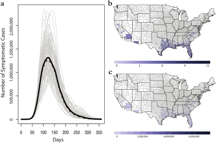
Figure 7.
The seasonal majority rule method for consensus building across ecological forecasts. (a) Mean (black) and median (dashed) trajectories for 100 epidemic simulations. (b) The majority rule map: shading represents the number of months each county is marked suitable for outbreaks. (c) Final average case totals in the seasonal majority rule method. Maps were made in R 3.3.268 (https://www.R-project.org), using U.S. Census shapefiles.

