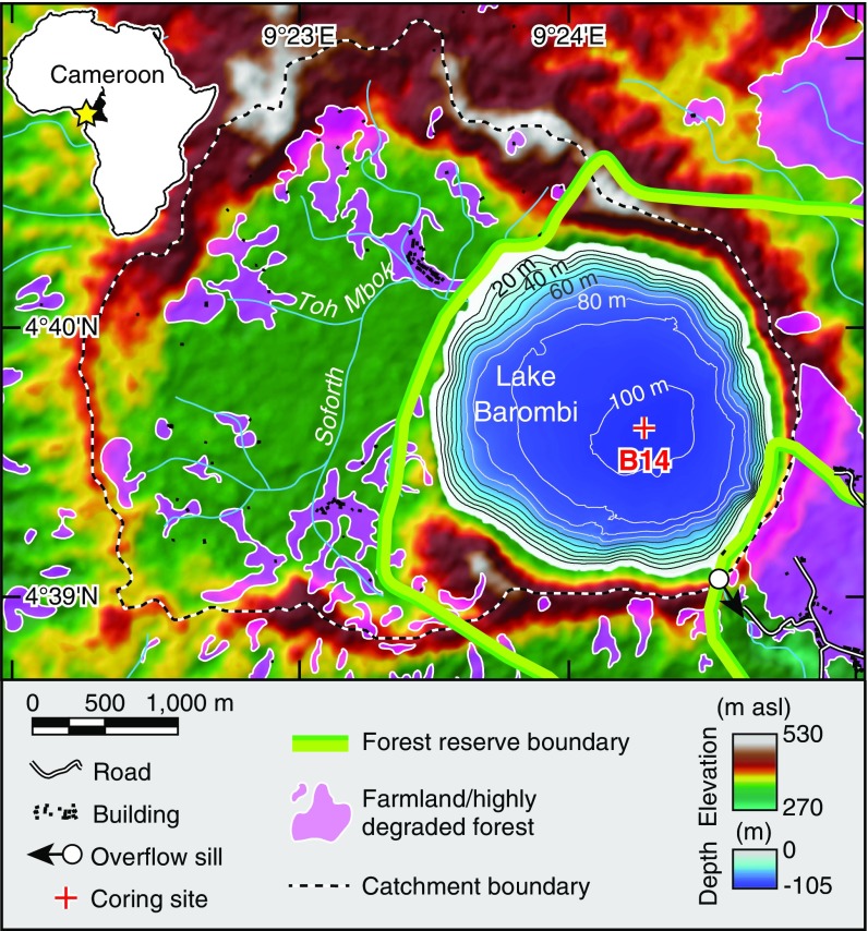
Fig. 1.
Map of the Lake Barombi basin with topography, bathymetry (10-m contour intervals), and the coring site. Also highlighted are infrastructures and farmland/highly degraded forest based on SPOT 5 images and ArcGIS Online Basemap–World Imagery (source: Esri, DigitalGlobe, GeoEye, i-cubed, USDA, USGS, AEX, Getmapping, Aerogrid, IGN, IGP, swisstopo, and the GIS User Community). (Inset) Location map of Lake Barombi (yellow star) in Africa.

