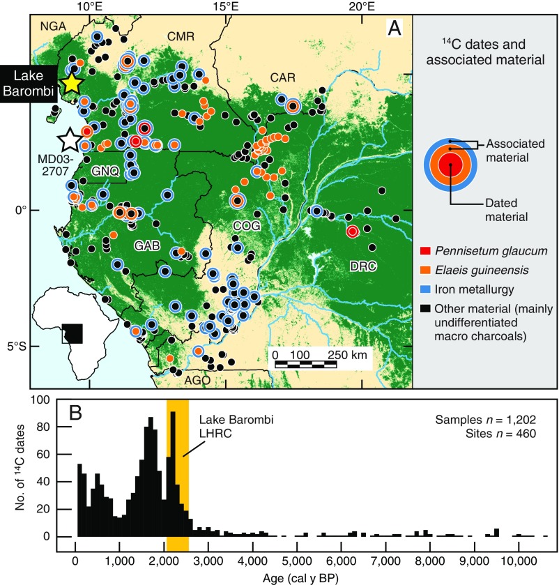
Fig. 3.
Map of WCA, the Lake Barombi study site, and spatiotemporal distribution of 460 archaeological sites covering the past 10,500 y. () Current spatial distribution of rainforest shown in green, taken from the Collection 5 Moderate Resolution Imaging Spectroradiometer (MODIS) Global Land Cover Type product (www.landcover.org). (Inset) Map showing location of the study area in Africa. Countries: AGO, Angola; CAR, Central African Republic; CMR, Cameroon; COG, Republic of the Congo; DRC, Democratic Republic of the Congo; GAB, Gabon; GNQ, Equatorial Guinea; NGA, Nigeria. Overlain are 14C-dated archaeological sites with dated and associated material as well as the location of Lake Barombi and marine core MD03-2707. () Number (No.) of 14C-dated archaeological samples per 100-y period. Vertical yellow band indicates the timing of the Lake Barombi LHRC.

