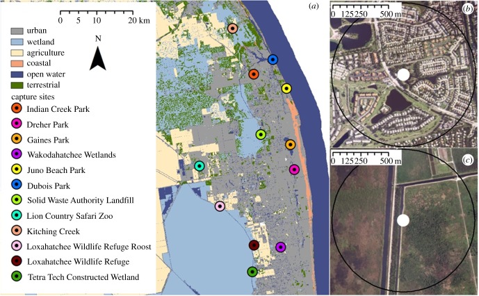
Figure 1.
(a) Map of ibis capture sites in Palm Beach and Martin Counties, Florida. Raster layer shows land cover categories reclassified from the Cooperative Land Cover (CLC) layer. Circles show capture locations ordered from most to least urban land cover within a 650 m radius (black circles in panels (b) and (c)). Our capture sites ranged from 91% urban land cover (b) to 0% urban land cover (c).

