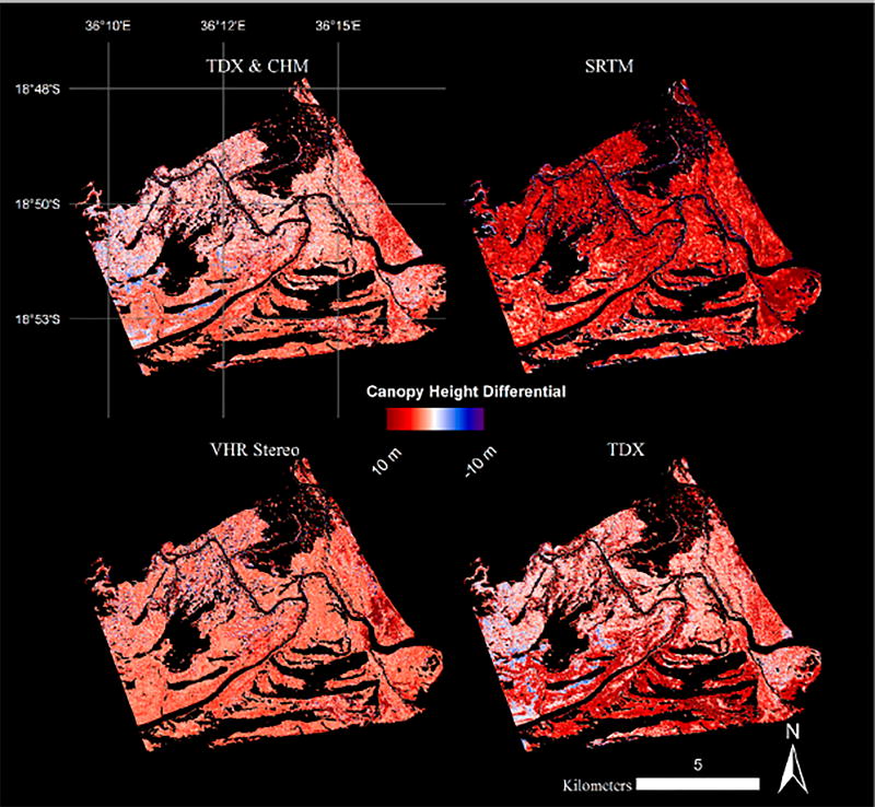
Figure 6.
Canopy height differentials between reference airbone lidar and other Canopy Height Models (CHMs) for a region of the Zambezi Delta (see black line on Figure 1 for region of interest): Fused Very High Resolution (VHR) and TanDEM-X (TDX), Shuttle Radar Topography Mission (SRTM), VHR Stereo, and TDX.

