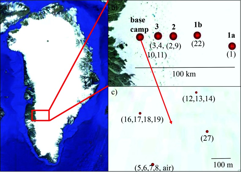
Fig. 1.
Map showing the location of field sites in southwest Greenland (a) across a 100 km transect from the base camp to further inland (b). Sites 1a, 2 and 3 were sampled on 27 July and sites 1b, 2 and 3 were sampled on 5 August 2016. The samples around the base camp were collected over a 3-week period (c). Labels in bold type above the red dots represent site names and those below in parentheses indicate sample numbers. Full details can be found in Table 1. (Image source: Google Earth, 23.06.2017).

