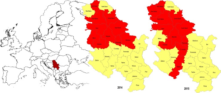
Fig 1. Categorization of districts in the Republic of Serbia according to risk of WNV outbreak.
The figure show the geographic position of Republic of Serbia in Europe. The districts (NUTS3) with higher risk of WNV infection are marked in red (10 districts in WNV surveillance programme in 2014 and 11 districts in WNV surveillance programme in 2015), and the districts with lower risk of WNV infection are marked in yellow. The solid black lines in the maps of Republic of Serbia represents the borders of districts (25 districts in Serbia that were under WNV surveillance in 2014 and 2015). The northernmost seven districts represent the Autonomous Province of Vojvodina. Description of the sampling locations: Districts names, geographic coordinates and web links are provided as the supporting information S3 Table. The basic administrative maps were extracted from the GADM database of Global Administrative Areas (www.gadm.org), version 2.8, November 2015, and later on changed according to the data presented in them.

