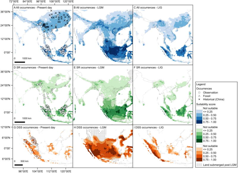
Figure 2. Predicted distributions of Sumatran Rhinoceros.

All occurrences (top panel) include Dicerorhinus sumatrensis and Rhinoceros spp.; SR occurrences (middle panel) include D. sumatrensis; DSS occurrences (bottom panel) include SR occurrences from Sumatra and Peninsula Malay (D. s. sumatrensis). Occurrences for Rhinoceros spp. are denoted with an × while known Sumatran Rhinoceros occurrences are denoted with open circles. Likely historical occurrences of Sumatran Rhinoceros are denoted by triangles. A grid is overlaid on the maps in the second column to denote emergent land during the last glacial maximum (LGM). The areas with suitability scores lower than the minimum training presence threshold are considered ‘not suitable.’ The land submerged post LGM are the areas ca. 120 m below sea level on the bathymetric map (see also Figure S2, Figure S3, Table S2 and Table S3).
