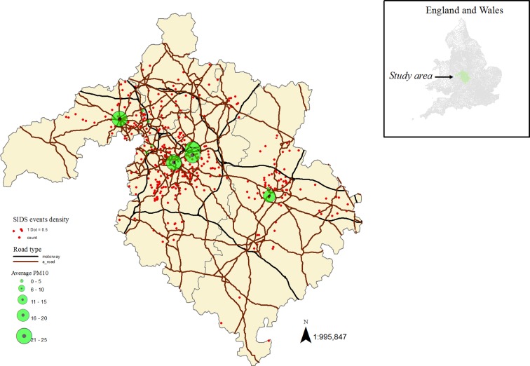
Figure 1.
Air pollution monitoring sites with road networks (motorways and A-roads) and sudden infant death syndrome (SIDS) events in the study area. We used ArcGIS Desktop V.10.2 (http://www.esri.com/software/arcgis) to create the map combining shapefiles for postal code areas and motorways and overlaying air pollution and SIDS data.

