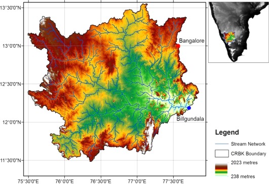
Figure 1.

The Cauvery River Basin in Karnataka (CRBK) location, topography, and stream network developed using the Advanced Spaceborne Thermal Emission and Reflection Radiometer (ASTER) Digital Elevation Model (DEM). The Western Ghats form the western ridge of the basin, whereas Bangalore is located on the north‐eastern ridge (red dot). The river flows in a south‐easterly direction toward downstream Tamil Nadu, and the outlet of the CRBK is Billgundala (blue dot).
