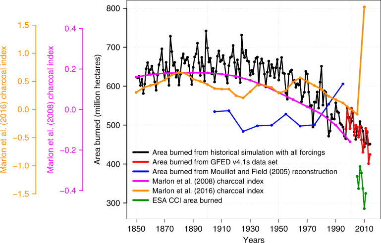
Fig. 2.
Comparison of simulated area burned with other observation-based estimates and charcoal indices. The satellite-based products include the GFED 4.1 s14,15 data set for the period 1997–2014 and the European Space Agency’s Climate Change Initiative (ESA CCI) for the period 2005–2011. Global charcoal indices are from the Global Charcoal Database12,13 (GCD, based on 200812 and 201613 publications). The decadal reconstruction of global burned area for the 20th century from Mouillot and Field26 is based on land use practices, qualitative reports and local studies

