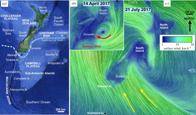
Figure 1.
Topography and weather events in New Zealand and the Southern Ocean. (a) Onshore and offshore topography (from GoogleEarth) of the New Zealand crustal area and adjacent deep ocean. The STF oceanographic barrier represents the boundary between warm-temperate versus cold-sub-Antarctic water masses. (b) Easterly surface winds of Cyclone Cook on 14 April 2017, from earth.nullschool.net (adapted from [20]). (c) Surface wind model for the southerly storm of 21 July 2017. (Online version in colour.)

