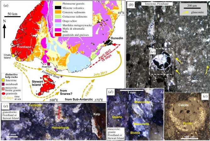
Figure 5.
Geological controls on sources of kelp rafts on Dunedin beaches in the two 2017 weather events. (a) Geological map of southern New Zealand, showing inferred kelp rafting pathways, estimated transit times based on barnacle sizes and distinctive rock types that identify potential source areas. (b,c) Limestone bearing foramenifera from Chalky Island, Fiordland (d) Muscovite granite inferred to have been derived from Stewart Island or Fiordland. (e) Granodiorite derived from either Fiordland or Stewart Island. (Online version in colour.)

