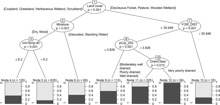
FIG 5.
Decision tree depicting simple implementable rules for isolation of generic E. coli from surface soils. Bracketed rules indicate classifications from the USGS NLCD (land cover), USDA SSURGO (DrainClass) or field observation (moisture). FOR_DIST is proximity to nearest forest cover based on USGS NLCD. pCrp_250 is percent cropland cover in 250 m based on USGS NLCD. minTemp.d0 is the minimum temperature (in degrees Celsius) on the day of sampling (day 0) at the nearest NOAA climate monitoring location. Percent forest cover and percent cropland cover are inversely related and equally informative according to random forest analysis.

