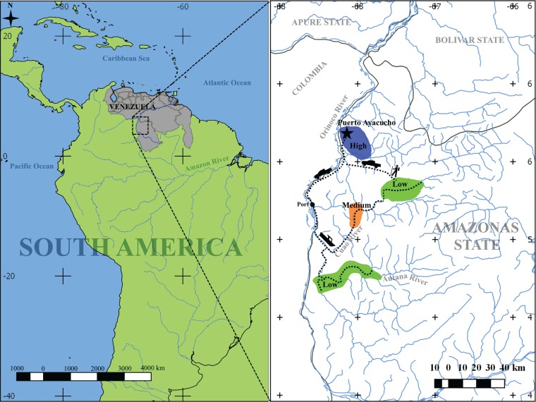
FIG 1 .
Diagram of geographic locations included in this study. Sampling was performed at eight locations with different urbanization levels: five locations with low urbanization level (green), one location with medium urbanization level (orange), and two locations with high urbanization (blue). Distances to the urban town were 150 to 210 km (by road and river) for the medium and low urban-level communities. Most communities can be reached only by river; however, some low-level urban communities can be accessed by 1 to 2 days of trekking through the forest. The medium urban level community is located 190 km from an urban location (130 km by river and 60 km by road). The two high urban level communities are located 8 km from each other. The map was generated using Quantum GIS Geographic Information System v. 2.18.14 (https://www.qgis.org/en/site/).

