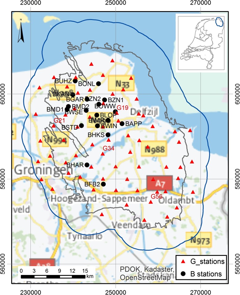
Fig. 1.
Location of recording stations in the Groningen field in the north of the Netherlands: 18 surface stations and 68 vertical array stations. Labels are shown for all 18 surface stations (coded B) characterised in this study and for the vertical array stations (coded G) from the examples in this paper (Figs. 16 and 18). Grid coordinates refer to the Dutch Ordnance System. The inset shows the location of the gas field in the northern part of the Netherlands

