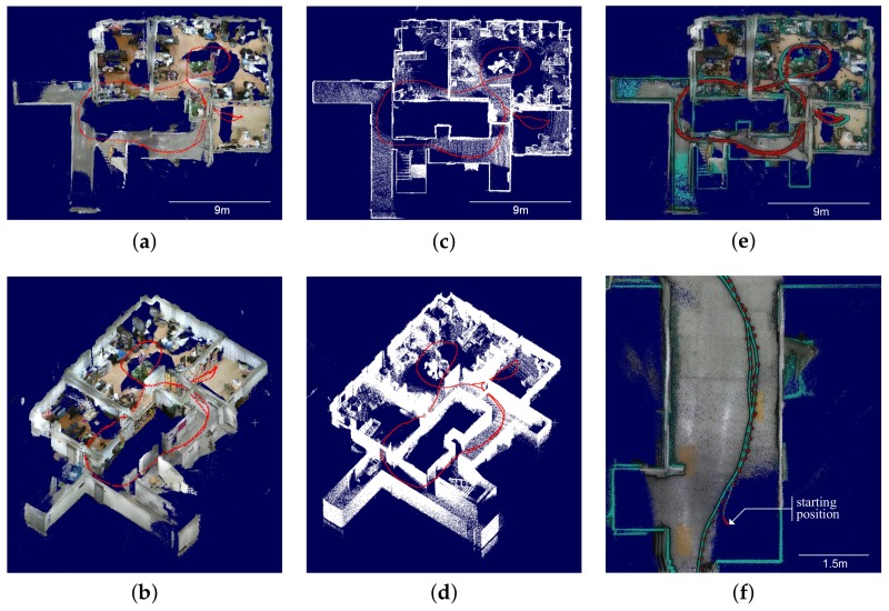
Figure 8.
Trajectories and mapping results with truncated ceiling. (a) optimized map top view; (b) optimized map bird’s-eye view; (c) ground truth map top view; (d) ground truth map bird’s-eye view; (e) superimposed map top view; (f) superimposed map close-up view. (a,b) display RGB-D map optimized by the proposed method using low-cost sensor system. (c,d) show ground truth acquired using high-cost sensor system. (e,f) show superimposed map between the optimized map and the ground truth, where green-colored point cloud and trajectory are the ground truth. To improve depth visualization, an eye-dome lighting shader is applied to (e,f) where the point cloud of ground truth is randomly subsampled by 10%.

