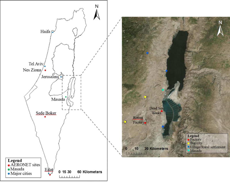
Figure 2.

Study Area. Left: a map of the area of Israel, with the Dead Sea region highlighted by the dotted line (major cities, AERONET stations, and Masada historical site marked); Right: an enlargement of the study area (rural settlements, cities, and industrial zones marked). The historical site of Masada is also marked.
