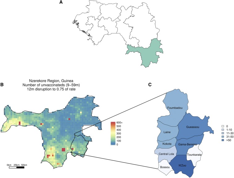
Figure 1.
(A) Map of Guinea, with regions outlined and the Nzérékoré region highlighted. (B) Zoomed in, we see the number of susceptible individuals in the Nzérékoré region of Guinea if a 25% interruption of measles vaccination due to the impact of Ebola on the healthcare system is assumed. Lola prefecture is in the lower right-hand corner of the map and is seen in (C) with labeled subprefectures. The color of each subprefecture coincides with the number of reported measles cases up to week 13 of 2015. This figure appears in color at www.ajtmh.org.

