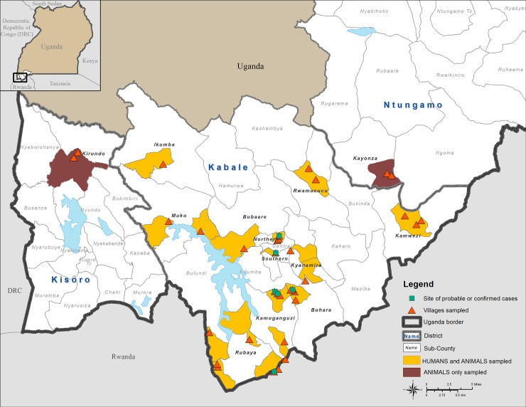
Fig 1. Map of Kabale district showing locations where either humans and animals, or animals only, were sampled in proximity to locations where confirmed acute or probable RVFV human outbreak cases were identified.
This figure was created specifically for this manuscript in ArcGIS using open source data from ESRI and DIVA-GIS for the background layers, and GPS points collected in the field for the points. (ESRI—http://opendata.arcgis.com/about, DIVA-GIS—http://www.diva-gis.org/).

