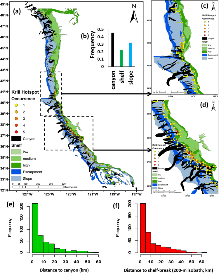
Figure 3.
(a) Distribution of significant krill hotspots, classified by their re-occurrence, and overlaid on geomorphic features, including: canyon, slope, and shelf habitat; (b) inset, highlighting the frequency of krill hotspots detected with geological habitats; (c,d) areas in the northern and central-northern California Current highlight the association of krill hotspots within canyons and where canyon heads intersect the continental shelf; (e,f) frequency of krill hotspots relative to distance (km) to nearest submarine canyon and shelf break (200 m isobath contour separating shelf and slope habitats). Map created by the authors using ArcGIS (v 10.3.1; ESRI, 2015); see Methods for description of marine geology features.

