
Fig. 1.
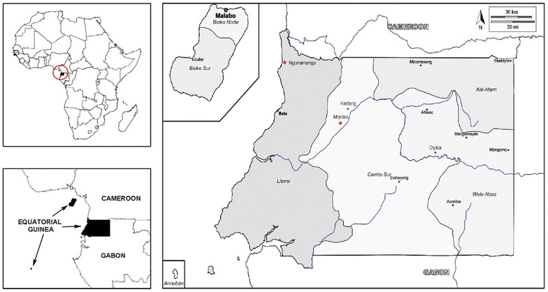
Map of Equatorial Guinea with study areas. The country’s capital is Malabo, on Bioko Island. Sampling took place in two villages of mainland Equatorial Guinea, Ngonamanga and Miyobo (red stars). Ngonamanga (Litoral province, N 02°09′34,5″; E 009°47′54,4″) is a coastland village, isolated from the main trade routes, having an older population, whereas Miyobo (Centro Sur province, N 01°44′56,40″; E 10°10′40,05″) is a village in the interior, but closer to a developing city Niefang and nearby a main road, having a younger population [4]