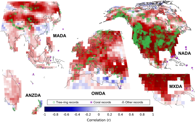
Figure 3. Reconstruction assessment using drought atlases.
Correlation between the data assimilation-based PDSI reconstruction and the PDSI reconstructions of the drought atlases from the years 1500–2000: the North American drought atlas (NADA)14,51, the Old World drought atlas (OWDA)15, the Monsoon Asia drought atlas (MADA)52, the Mexican drought atlas (MXDA)53, and the Australia and New Zealand drought atlas (ANZDA)54. Correlations are computed using the JJA reconstruction for NADA, OWDA, MADA, and MXDA and the DJF reconstruction for ANZDA. Prior to computing the correlations, the drought atlases were interpolated to the land surface grid of the CESM LME model simulation used in the data assimilation-based reconstruction presented here.

