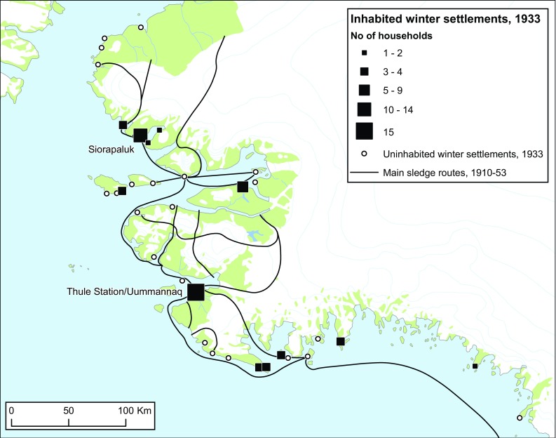
Fig. 8.

Active winter settlements and their number of households in 1933. Marked concentrations of families are seen at the Thule Station itself and at the newly established trading post Siorapaluk. The black lines represent the main sledge routes during the Thule Station Period, 1910–1953. Note that several routes lead across fringe areas of the Inland Ice. They served partly as shortcuts, partly as ‘escape routes’ in case of open water, unstable sea-ice conditions or lack of an ice foot at the coast.
Reproduced with Permission from Holtved (1935, 1937); Holtved (1944); Gilberg (1971); Grønnow (2016)
