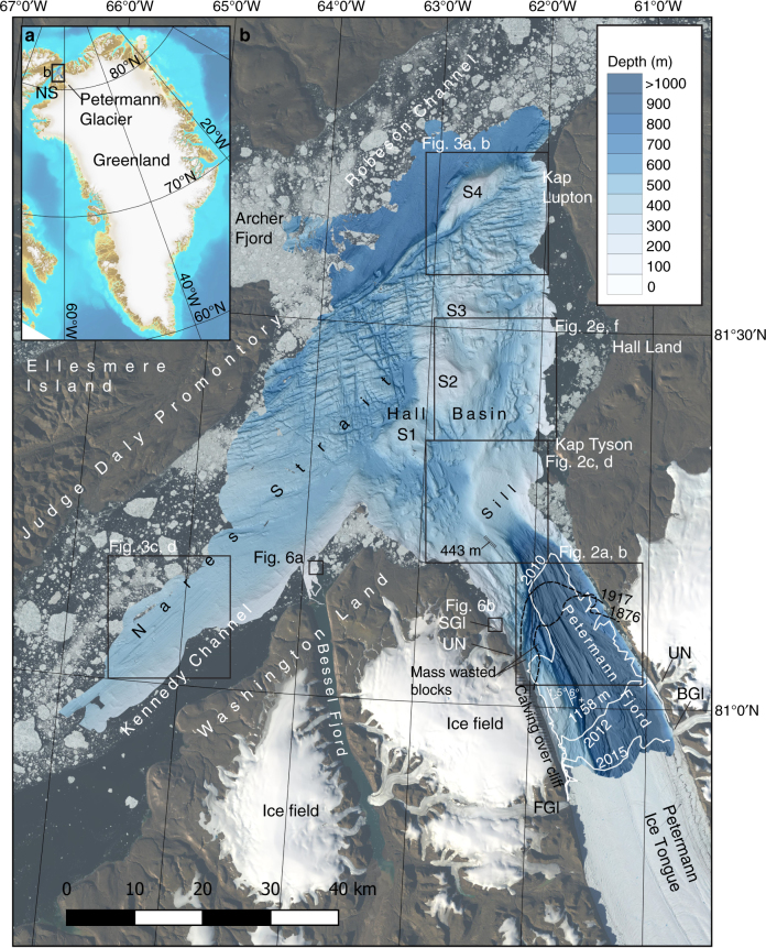
Fig. 1.
Overview maps of the studied area. a The location of Petermann Glacier and the focus area of the Petermann 2015 Expedition with Swedish icebreaker Oden. b The multibeam mapped area of the Petermann Fjord and adjacent Nares Strait. The bathymetry is portrayed with a shaded relief based on a 15 × 15 m cell-size grid from the processed multibeam bathymetry (see Methods). The location of the Petermann Ice Tongue margin is shown at five different points in time; for 2010 (July 22), 2012 (July 3) and 2015 (Aug 2), the margins are based on Landsat images (white lines), while the margins have been digitised from published maps for 1876 and 19177,8 (stippled black lines). Note that the 2010 and 2012 locations of the margin are prior to the main calving events that occurred those years. The areas of the detailed maps shown in Figs. 2–6 are outlined with black boxes. The strike and dip of the bedrock planes in the western side of the fjord as revealed by the multibeam bathymetry are marked as well as the deepest mapped location (1158 m) and the deepest spot in the sill (443 m). BGl Belgrade Glacier, FG1 Faith Glacier, NS Nares Strait, SGl Skidbladner Glacier, UN Un-Named glacier. S1–S4 are bathymetric shoals

