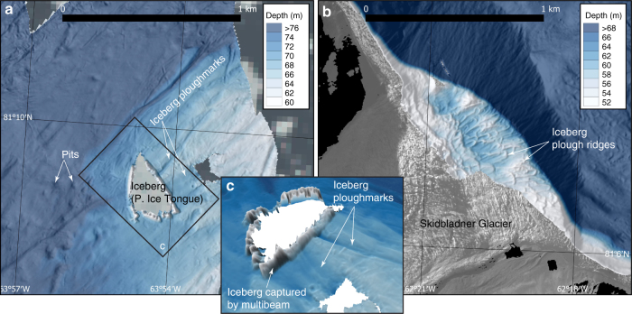
Fig. 6.
High-resolution bathymetry from the RV Skidbladner surveys. a Seafloor bathymetry of the area where one of the icebergs grounded that calved from the Petermann Ice Tongue during the expedition. b Seafloor bathymetry showing iceberg plough ridges in front of Skidbladner Glacier. c 3D-view of the mapped seafloor around the grounded iceberg. The sidewalls of the iceberg are mapped by the multibeam sonar and clearly visible in the data. The bathymetric shaded reliefs in a, b and c are based on processed grids (3 × 3 m cell size) from the RV Skidbladner surveys

