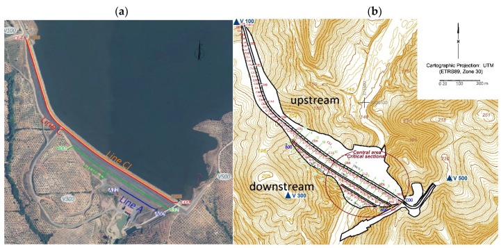
Figure 2.
(a) Locations of control lines at the berms (lines A and B) and on the downstream (line C) and upstream side of the crest (line CI). (b) Locations of the control points for high precision geodetic observations and distribution of the cross sections (critical sections) for numerical modeling.

