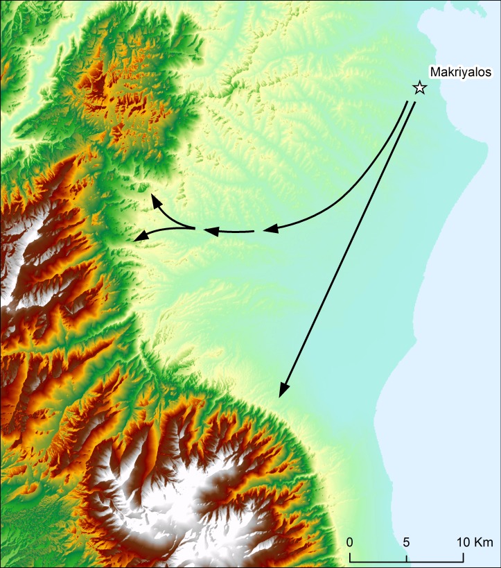
Fig 4. Topographical map of northern Pieria.
Indicated are approximate routes, involving minimal vertical travel, from Makriyalos to geologically older zones. The northern route leads to the Cretaceous limestones and Neopaleozoic/Paleozoic formations in the Pieria Mountains. The southern route leads to the Mesozoic limestones in the Olympus mountain range. Prepared in ArcGIS 10.2 using Digital Elevation Model from Yamazaki et al. [6].

