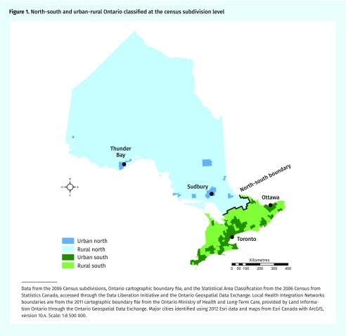
Figure 1.
North-south and urban-rural Ontario classified at the census subdivision level
Data from the 2006 Census subdivisions, Ontario cartographic boundary file, and the Statistical Area Classification from the 2006 Census from Statistics Canada, accessed through the Data Liberation Initiative and the Ontario Geospatial Data Exchange. Local Health Integration Networks boundaries are from the 2011 cartographic boundary file from the Ontario Ministry of Health and Long-Term Care, provided by Land Information Ontario through the Ontario Geospatial Data Exchange. Major cities identified using 2012 Esri data and maps from Esri Canada with ArcGIS, version 10.4. Scale: 1:8 500 000.

