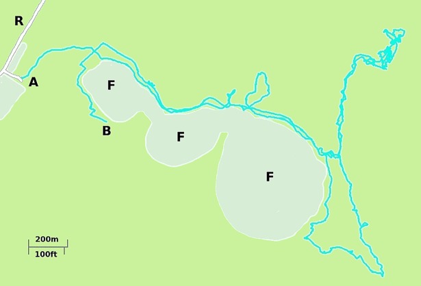
Fig 6. Typical example of a GPS recorded trajectory followed by an individual while executing a nut gathering excursion in the Amazonian rainforest in Rondônia, Brazil exhibiting the local terrain features as well.
In some cases forest features (i.e. changes in canopy density) other than footpaths are used when walking, these may include the borders of forest gaps where vegetation is secondary or primary (F) and is somewhat more easy to walk. A is the start and B the end of the trajectory, R is a dirt road. Location coordinates: 10°53'40.68" S, 65°03'44.68"W. Map elaborated from our own GPS records. See S1 File for more details about this figure.

