Figure 1.

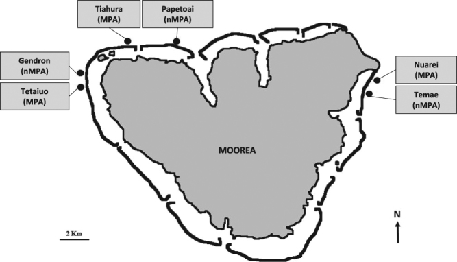
Map of recording sites in three Marine Protected Areas (MPA) and three non-Marine Protected Areas (non-MPA). Map drawn by the authors from an aerial photograph of Moorea taken by the CRIOBE in 2008 from a private plane.

Map of recording sites in three Marine Protected Areas (MPA) and three non-Marine Protected Areas (non-MPA). Map drawn by the authors from an aerial photograph of Moorea taken by the CRIOBE in 2008 from a private plane.