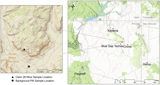
Figure 1.
Location of Claim 28 mine site in the Blue Gap Tachee Chapter of the Navajo Nation. Triangle (▴) and asterisks (*) in inset map denote location of sediment sampling for mine site and background particulate matter (PM). (Data Sources: Esri, HERE, DeLorme, increment P Corp., NPS, NRCan, Ordnance Survey, OpenStreetMap contributors, USGS, NGA, NASA, CGIAR, N Robinson, NCEAS, NLS, OS, NMA, Geodatastyrelsen, Rijkswaterstaat, GSA, Geoland, FEMA, Intermap and the GIS user community; USGS The National Map: National Boundaries Dataset, 3DEP Elevation Program, Geographic Names Information System, National Hydrography Dataset, National Land Cover Database, National Structures Dataset, and National Transportation Dataset; U.S. Census Bureau—TIGER/Line; and USFS Road Data).

