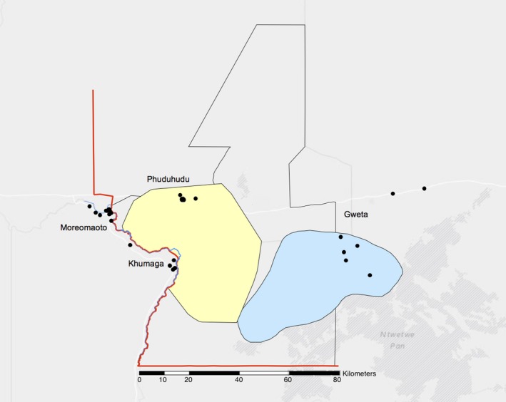
Figure 1.

A map of the study area showing the locations of the four study villages and enrolled kraals (black dots) which make up each village, and range of zebra migration (wet season: blue, dry season: yellow) in the Makgadikgadi and Nxai Pans National Park (MPNP) region. Note the fence (red line), river (blue line) and park boundary (black line) overlap on the west side of the park. Adapted from Bradley (2012)
