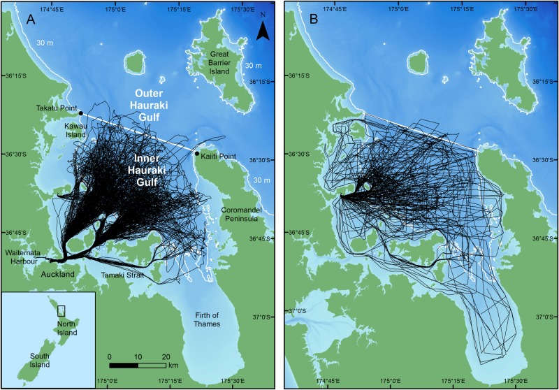
Fig 1. Survey tracks (black lines) of a) tour and b) research vessels in the inner Hauraki Gulf, New Zealand.
The solid black line indicates the boundary between the inner and outer HG. The white and yellow lines indicate the 30 and 100 m isobaths, respectively. Bathymetry is depicted with darker shades of blue representing deeper waters (reprinted from NIWA under a CC BY license, with permission from NIWA original copyright 2012; [93]). Inset: Location of the Hauraki Gulf and other places referred to in the text in relation to the North Island of New Zealand.

