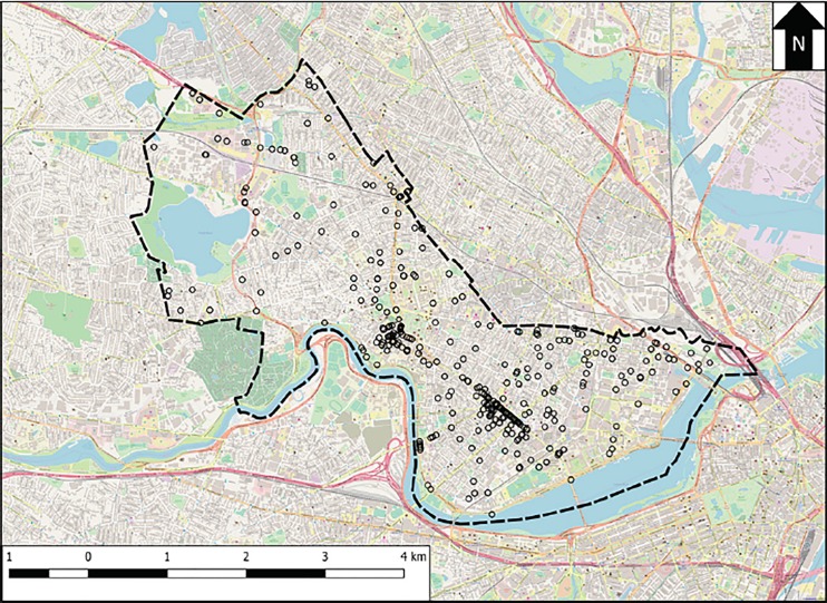
Figure 1.
Map of locations of opioid-related emergency medical services (EMS) runs in Cambridge, Massachusetts (MA). Open circles represent locations at which at least one EMS run occurred during the study period. The dashed line shows the border of the city of Cambridge, MA. A scale bar is provided in the bottom left, and the arrow labeled “N” at the top right points due north. Background map data, obtained from OpenStreetMap contributors, is available at www.openstreetmap.org.

