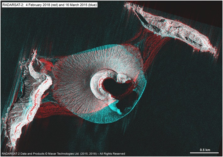
Figure 2.

Canadian Space Agency Radarsat‐2 Spotlight SAR images from 16 March 2015 (blue) and 4 February 2018 (red) at ~2 m spatial resolution (C‐band HH at 44° incidence), orthorectified using DEMs generated from DigitalGlobe acquisitions close in date. The loss of ~20% of the island's initial area from marine erosion over time is evident, with redeposition as isthmus deposits (in red) to the NE and SW. Zones of incipient slope failure can be observed on the inner crater walls in blue. RADARSAT‐2 Data and Products © Maxar Technologies, Ltd. (2015, 2017)—All Rights Reserved. RADARSAT is an official mark of the Canadian Space Agency.
