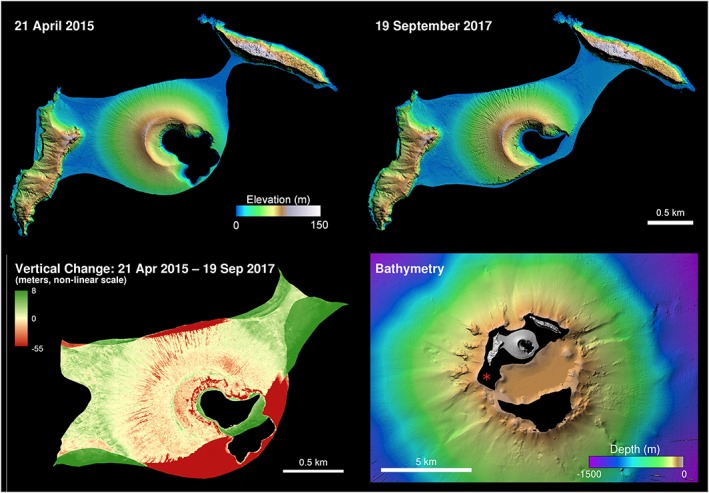
Figure 3.

Initial (upper left) and 2017 (upper right) DEMs of Hunga Tonga Hunga Ha'apai at 1‐m ground sample distance. The April 2015 DEM indicates a volume of 0.0479 km3, whereas the September 2017 DEM (upper right) indicates a volume of 0.0430 km3, a loss of 0.0049 km3 in 2.5 years. If this simple volumetric erosion rate holds constant, the island will disappear in ~18.7 years. The lower left panel illustrates the difference of the two DEMs illustrated above (top), with areas of erosion in red and accretion in green (with levels shown in meters); it reflects −0.004272 km3 lost in the major cliff erosion zones, leaving another 0.00087 km3 (17%) of loss within the rest of the DEM. The lower right panel depicts the bathymetry (5 m ground sample distance) of the Hunga Tonga Hunga Ha'apai island vicinity as measured from the R/V Falkor in April 2016. Total estimated edifice volume above caldera floor (at −155 m) is ~0.50 km3, with ~11% of that above mean sea level. The basal diameter of the edifice is ~1.5 km, with total relief above this submarine base of ~280 m (relative to the interior of the Hunga caldera). The red asterisk indicates the location of the 2009 eruption (Vaughan & Webley, 2010) which washed away after a few months.
