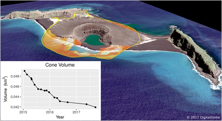
Figure 4.

Perspective view of the 19 September 2017 DigitalGlobe WorldView‐2 image as viewed from the southeast, with superimposed outline of the late January 2015 coastline and reconstructed initial topography. The tan/orange region is the footprint of the preerosional primary tuff cone that formed Hunga Tonga Hunga Ha'apai island, before a land‐bridge connected it to the older Hunga Tonga (right). Marine erosion due to wave action from the south and SE in this near‐shore shallow‐water region is dominantly responsible for the pattern of island system response, with deposition of most of the eroded materials on the widening northeastern isthmus. The inset graph illustrates the volumetric change over time since January 2015. See text for details (Table 1 and Figure S1).
