
FIGURE 2.
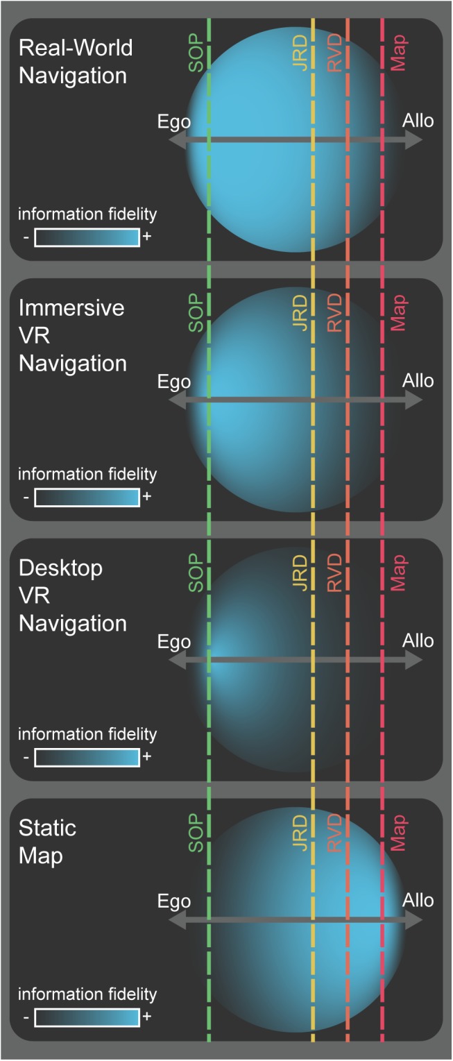
Conceptual model for the encoding and deployment of spatial information. Hypothetical spatial information (blue circles) acquired during early encoding of a novel environment via various encoding modalities (labels, left). Each example shows the fidelity of spatial information acquired (density and center of mass for blue circles) along an egocentric-to-allocentric continuum (dark gray, horizontal axes). The extent to which the circles project outward from the egocentric-allocentric axis illustrates information that, while not strictly spatial in nature (e.g., semantic or episodic memory), can be used to derive spatial information or drive inferences about the environment. The offset of the vertical, dashed, lines from the center of the egocentric-allocentric axis represents the hypothetical proportion to which that task depends more on egocentric or allocentric reference frames for its optimal solution (SOP: green, JRD: yellow, RVD: orange, map drawing: red).