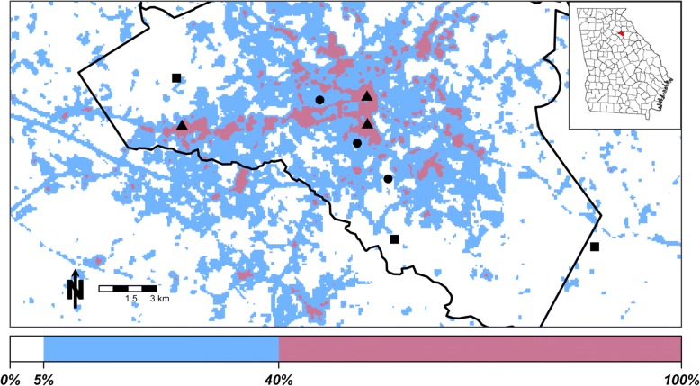
Fig. 1.
Map of study sites in Athens, GA, USA. Inset illustrates location of Athens-Clarke County (black outline) in the state of Georgia. Symbols represent land classes (square: rural; circle: suburban; triangle: urban). Colors represent the amount of impervious surface within the 210 m focal area of each pixel, as illustrated on the color bar on the bottom

